
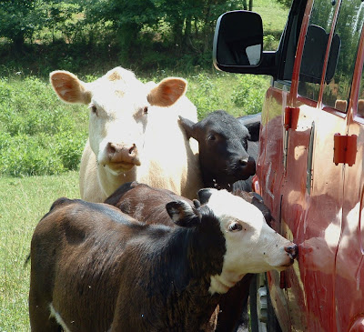
After two days of regional survey, we narrowed our activities to the site which will be the focus of the rest of the field school. By no means are we alone at the site. The immediate environs are home to dozens of cattle who insist on licking (for salt) and other wise crowding around the project van.
Today the students learned several elements and steps in creating a site map. These methods are illustrated in the video below
- Contour walking. Utilizing a GPS, the students followed the contours of a nearby hill, to experience and understand elevations on topographic maps.
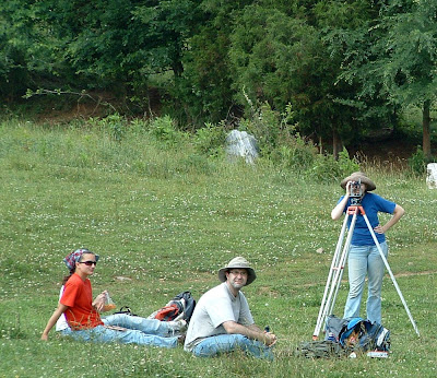
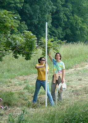
- Collecting topographic data. All of the students took measurements from various points in and around the site, using a traditional surveyor's transit. Utilizing such equipment and collecting and transforming the data by hand, rather than with a computerized total station, teaches the methodological principles behind mapping. As the season progresses, students will also utilize the computerized total station.
- Mapping topographic data. After a good day in the hot sun, the students returned to the lab, and created a topographic map using the data they collected earlier.

Today the students learned several elements and steps in creating a site map. These methods are illustrated in the video below
- Contour walking. Utilizing a GPS, the students followed the contours of a nearby hill, to experience and understand elevations on topographic maps.
- Collecting topographic data. All of the students took measurements from various points in and around the site, using a traditional surveyor's transit. Utilizing such equipment and collecting and transforming the data by hand, rather than with a computerized total station, teaches the methodological principles behind mapping. As the season progresses, students will also utilize the computerized total station.


- Mapping topographic data. After a good day in the hot sun, the students returned to the lab, and created a topographic map using the data they collected earlier.
No comments:
Post a Comment