Today we continued excavations in six 2 meter x 2 meter units. Three are located near what we believe to be the outer palisade of the Cherokee town, and three more are located in an area with high concentrations of bone and shell. These concentrations might indicate a living area (possibly where domestic structures were built,) and as they are adjacent to an area with scarce artifacts compared to the rest of the site, we are hazarding a guess that maybe our artifact concentrations indicate houses on the edge of a plaza. That would certainly be accurate when compared to eighteenth-century Cherokee town plans, but part of our research will be to try to determine if this town (occupied in the sixteenth century) follows the later layouts recorded by European observers in their interactions with the Cherokee.
As Cat’s post mentioned, we are using an arbitrary measure of 10 cm for our first level. Because the field we are working in has been used agriculturally for several years, the stratigraphy of the site (the original layers in which artifacts and soil were deposited) has been disturbed by the plow. The churning action of the plow is great for the soil and crops, but very, very bad for archaeologists. Any artifacts found in the plow zone can not be accurately linked to their original deposition site, but can still give us information regarding the features below. Artifacts are pulled up to the surface by the plow, but travel only a small distance from their original location. If we analyze the artifacts found on the surface, we begin to see patterns—for example, a large concentration of bone, pottery, and shell might indicate an area where people were cooking and eating, while a large concentration of chert flakes might indicate an area where lithic (stone) tools like projectile points, knives, and scrapers were being worked. This kind of spatial analysis gives archaeologists a better idea where to dig, especially when faced with an enormous field, a small crew, time constraints, and a limited budget! This bird's-eye-view photo taken from the top of the hill next to the field only shows about a sixth of the full field.

We began excavating yesterday, but had barely begun to scratch the surface when the call came to close up our unit. Here is what the unit Steve and I have been working on looked like first thing this morning:

There are three units in the photo in a sort of checkerboard pattern, almost like a “U”. Note the second group of three units in the distance near the top left of the photo.
Although it is hard to see in the photo, our unit had an enormous hump of soil right in the center caused by the tractor’s wheels, so although we took our elevation in the highest corner, we still had to work down through an extra 5 or 6 cm of soil before we even hit level. It felt like we moved a tremendous amount of dirt today, although it may not look like it in the photo below:

This is what our unit looked like at the end of the day. We are about halfway to our 10 cm mark!
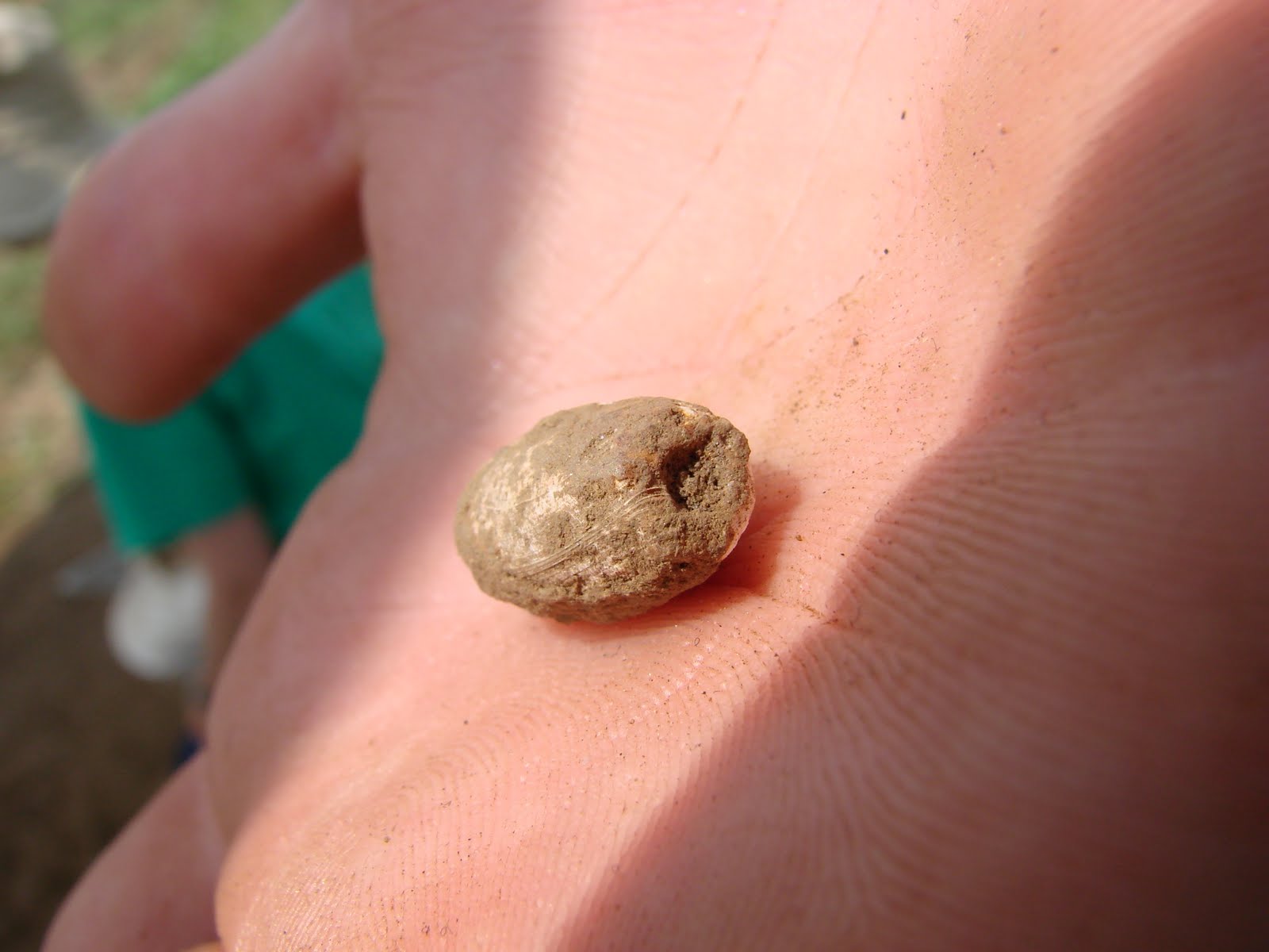
While screening this afternoon, Steve found a very cool shell bead. It is called a columella bead, and its name comes from the Columella snail shell from which it was made. You can check out a pretty neat x-ray of the shell on the wikipedia page linked here: http://en.wikipedia.org/wiki/Columella_(gastropod). Interestingly, the book Cherokee Prehistory by Roy S. Dickens, Jr., notes that similar beads were found on two sites in western North Carolina, very close to where we are working.
This website focuses mainly on northeastern native groups, but it has some very interesting information about the creation of shell beads: http://www.wampumbear.com/P_History%20of%20Wampum.html. Here is a picture of the bead from our unit:
Hopefully we’ll have more exciting finds next week!
No comments:
Post a Comment