Showing posts with label illinois state university. Show all posts

Thursday, June 17, 2010

Day 13 and 14 - Getting to the Bottom of Things


The last couple of days in the field have proven to be rather eventful - students have finally reached the bottom of the plow zone in their units, and have descended onto the cultural layer that is the focal point of this archaeological investigation. Although this layer is a sort of "living surface" with culturally sterile soil not far below, this is the layer where features such as post molds and structural foundations are going to turn up and is thus vitally important. Students will from this point onward trowel very carefully and deliberately through their levels.

Most units have shown a mottled soil still consisting of some plow zone soil. Some even have distinct trenches cut into the cultural layer filled with plow zone soil - a clear sign of a plow scar that long ago dug into that layer. One unit, however (20 South 22 East), does appear to have a post mold. It is nothing like the numerous post molds found in last years 20 South 15 East (which we uncovered again over the past couple of days for reanalysis and point of comparison with other units), but shows promise that an extensive number of structures once existed at this site.

The post mold in unit 20 South 22 East

Not surprisingly, artifact finds are proving to be more and more interesting. Some of the highlights include a couple of lithic cores, a few large pottery sherds with surface decoration, and one large piece of iron seen below.

The mysterious piece of iron.

Other than its material, we are unsure what sort of object it may have been. Based on its flat shape, we have speculated that it may have been attached to a wooden surface. The likelyhood of proper identification remains to be seen.

Most decorated pot sherds found over the last few days have either been check stamped or cord marked, both of which are surface treatment styles common to the Woodland Period of East Tennessee, but not necessarily unheard of in Mississippian and/or historical contexts.

A check stamped sherd, in situ.

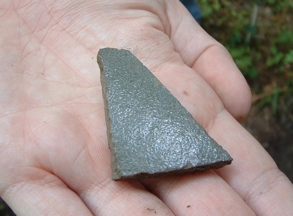
One sherd uncovered during the last couple of days, however, appears to be a rectilinear complicated stamped. Complicated stamped surface treatments are typical of Mississippian cultures found throughout what is today Georgia, South Carolina, and parts of northern Florida, North Carolina, Alabama, and Tennessee. This stylistic attribute is definitive of Mississippian and historic cultural sequences in western North Carolina and upper East Tennessee.

Though badly damaged in the plowzone, this sherd above shows the telltale stamped lines and corners typical of a rectilinear complicated stamp motif.

One of our field school students, Katie, proudly showing off the sherd, which was found in her unit.

The next few days of field excavation will only reveal more exciting artifacts and features, as students carefully excavate through the undisturbed cultural layer in their respective units. Tomorrow, however, the crew will be taking a field trip to the Berry site in North Carolina, where excavations are currently underway. Come Monday, students will be back to work for their final week of field work. Stay tuned to this blog for more updates!


Day 12 - "Snakes... Why Did it Have to be Snakes?"

What would an archaeology blog be without at least one Indiana Jones reference? Albeit an obscure one... The title for today's entry was inspired by our encounter with this impressive-sized black racer snake below:

Is it turning its nose up at us?

The snake eyed us suspiciously for a bit, and after it decided we were (mostly) harmless, lived up to its name and made a dash for the tree line.

The snake was not the only animal encounter today of note. The crew was also visited by some rather bold butterflies, who insisted on landing on us for long periods of time, presumably to consume salt off of our sweaty clothes.

This butterfly sat on Dr. Jeb Card for quite a long time.

Animal encounters aside, today was an unusual field day. The rumbling of thunder early in the morning set us packing out of the field before 11am, only to have us return again after 2pm to work until well after 4pm. Despite this peculiar schedule, and the by-now-to-be-expected heat and humidity, excavation still progressed nicely.

Students, especially those in the southern units, have begun encountering increasingly larger and more impressive artifacts - particularly lithic flakes. Some of the nicer samples from today can be seen below:


We also found our first piece of unaltered bone of the season today (we found pieces of calcined bone late last week). It looks to be a shaft fragment of a long bone of a cow or deer, thought cow is probably the likely candidate as we are excavating near a pasture.


We will continue to post more interesting finds as they are unearthed.

Friday, June 11, 2010

Day 10 - Crazy from the Heat

After two days of deluge, today's foray into the field was met with extreme heat and humidity. Despite this, and the usual exhaustion and exasperation such excavation situations bring, the work day proved to be very interesting. Although hot and humid, the ground and equipment were dry, and therefore we were able to devote a normal full day to field work. The day started with taking a Munsell reading of yesterday's levels, and then students began troweling and shovel-skimming their way down to the bottom of their level 3's. As the morning progressed, some of the students got up-close and personal with some of the local wildlife:


We have encountered about three spiders of roughly this size in the field so far this season. Aside from obvious examples such as tarantulas, these are some of the largest spiders many of us have ever seen. Let us hope "human" isn't on this critter's menu.

Despite the uncomfortable weather, work went on as usual. Here are a few notable action shots of the day:

Working hard sifting dirt.

This one goes to Eleven
(video clip in case you aren't familiar with the phrase)

Today's excavations produced a particularly interesting find: a very nicely-preserved check-stamped ceramic sherd.


Check-stamped ceramics are common during the Woodland period of East Tennessee, but are also not unusual in Mississippian or historic contexts as well. Many of the students agreed that this particular specimen was the nicest preserved one they had seen - possibly even nicer than other check-stamped sherds in our type collection!

One of the students showing off her spectacular find of the day: the check-stamped sherd.

Many other students were proud of their finds this week as well. Here are a few more pictures of students showing off their finds from earlier in the week:


A ceramic sherd.

Another ceramic sherd.

As the day progressed, the weather got increasingly oppressive. Thankfully, the owner of the land where the Yellow House site is located came to our rescue and brought us some tents to work under for the remainder of the afternoon. They were a pain to set up and take down, but they did provide a reprieve from the glaring sun for awhile.

Working in luxury.


As the afternoon progressed and the students continued digging, measuring, sifting, and bagging; Dr. Jeb Card and Burton Smith began opening up last year's unit 20S 15E, which was the unit with the post holes. We hope to have the living floor of this unit reopened for analysis and visual reference by early next week.

At the end of the day, most students had finished or had come close to finishing their level 3's. Between downpours, mud, and oven-hot conditions, the students persevered without complaint this week. With the arrival of the weekend, they get a much-needed break, and will begin again fresh on Monday.

Day 9 - Wet Day, Wet Screening

Here are a few images for Day 9, to compliment Jenna's post above.

Water-screening


The crew, working during a rare moment of dryness.

Everyone in the crew will keep their collective fingers crossed that things start to dry out soon. Despite the rain, progress is still being made.

An interesting note: Jessica, one of the students on the dig, discovered that one of the larger lithic pieces so far recovered from this season may in fact be a broken prismatic blade - a type common to this area during the Woodland Period.
Here is an image of the blade in question:

Thursday, June 10, 2010

Day 8 - Blame it on the Rain

by B. Smith

Unfortunately, field work was somewhat thwarted due to on-again-off-again (but mostly on-again) heavy downpours. The rest of the week does not look too promising either, with a 40% chance of rain up through Friday. Today, however, was especially rough - there were even some flash flood warnings for nearby towns. The executive decision was made to park our van at the top of the hill away from the site, so that we would have high enough ground to drive out of if the ground got too saturated. We wanted to avoid getting quagmired at all costs. The weather seemed to enjoy tormenting us: at least twice it would rain heavily, only to subside right about the time we managed to pack up all of our stuff into the van.

The van on the hill, during a rare dry moment.

Despite the rain, we were still able to accomplish some things in the field. Primarily, all students were able to check the soil coloration of the bottom of their unit via the Munsell color chart. Some were even able to make considerable headway into their next excavation level.

Using the Munsell color chart.

We ultimately had to leave early, due to concerns over wet equipment and soaked units, but students were able to make up for the lost time with more time spent in the lab with Dr. Jeb Card. Even with today's setback, progress in the field is still coming along very nicely.


Tuesday, June 8, 2010

Day 6 and 7 - Groundbreaking! (Excavation Begins)


By B. Smith

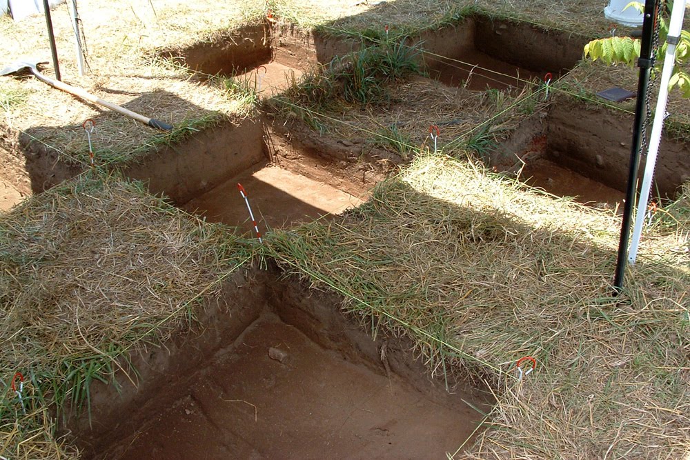
After a week of surveying and learning about some of the background history and prehistory of northeastern Tennessee, the students were finally ready to start breaking ground on the Yellow Cabin Site. Excavations this year will focus primarily on the area around last year's Operation 1, unit number 20 South 21 East, which produced some curious features filled with charcoal. On Monday the students started out helping to measure out 2X2 meter grids, which were subsequently subdivided into 1X1 meter grids to be converted into test units.

Measuring out a grid, and double-checking appropriate point distances with the hypotenuse.

Altogether, six units were parceled out for excavation - one per student, and an additional unit to be worked on by both lab director Dr. Jeb Card, and field director Burton Smith. After the students received their designated 1X1 test units, they began the arduous task of clearing off excess brush and tall grass off of the surface.

Clearing the surface.

Once the units were all reasonably cleared, the students assisted in shooting in elevation points in their units with the total station.

Holding the stadia rod and prism in place.

By Tuesday morning, students were ready to establish their datums and start digging down 5 centimeters to the bottom of their first level. Since the surface soil was plow zone and choked with thick roots, this task was accomplished through the use of shovels for skimming, with some troweling to smooth out the floor. The students struggled through the roots, but all managed to finish their first level by the end of the day. They even managed to bag, pack up, and haul away all of the dry-screened soil from their individual units, to be water-screened at a later date.

All students were able to finish their levels before the end of the day.

The plow zone at the Yellow House Site represents a completely disturbed context that can extend below the surface to about 20 or 25 centimeters. In spite of this decontextualized soil horizon, artifacts found here can still give clues to the nature of cultural activity preserved below the plow zone line. Students collectively uncovered several artifacts - sand or grit-tempered ceramic sherds, lithic flakes made from local chert, fire-cracked rocks, as well as the occasional artifact of more recent periods (plastic). Not bad for the first day!


Two examples of some of our first finds of the season - a couple of small ceramic sherds.

The students definitely deserve praise - they've worked very hard and diligently, and have been very productive with the time allotted for excavating. With any luck, we may yet be able to finish these first sets of units and open up new units around last year's Operation 5, unit number 20 South 15 East, which produced a series of small post holes.

Friday, June 4, 2010

Day 4 - Mapping


After two days of regional survey, we narrowed our activities to the site which will be the focus of the rest of the field school. By no means are we alone at the site. The immediate environs are home to dozens of cattle who insist on licking (for salt) and other wise crowding around the project van.


Today the students learned several elements and steps in creating a site map. These methods are illustrated in the video below

- Contour walking. Utilizing a GPS, the students followed the contours of a nearby hill, to experience and understand elevations on topographic maps.

- Collecting topographic data. All of the students took measurements from various points in and around the site, using a traditional surveyor's transit. Utilizing such equipment and collecting and transforming the data by hand, rather than with a computerized total station, teaches the methodological principles behind mapping. As the season progresses, students will also utilize the computerized total station.


- Mapping topographic data. After a good day in the hot sun, the students returned to the lab, and created a topographic map using the data they collected earlier.


Wednesday, June 2, 2010

Day 3 -- Survey of Washington County

By Project Director, Dr. Kathryn Sampeck


Moving out of our home base and environs, today we broadened horizons and explored the numerous historical sites of Washington County, Tennessee. In comparison with the parts of Greene County we visited yesterday, we could appreciate some of the unique features of early historic settlement in Washington County. One of these is the abundance of rich soils near the Nolichucky River. Cherokee towns in Washington County often were situated in pairs, one on each side of the river, a pattern not seen in Greene County, where fertile river plains on one side often face steep bluffs on the other shore. These paired villages in Washington County may have had a distinctly different sociopolitical dynamic because they could see each across the river.

The Nolichucky River

We have to remember that the more recent sociopolitical division of Washington and Greene Counties should not overshadow our interpretations of the past. We also noted that today's county divisions perhaps encourage us to think that areas were divided, but we could see that some areas between Washington and Greene County were easily accessible by the old road system. We noticed that in general, Washington County had more early historic Cherokee towns (after contact with Europeans) that were fairly regularly spaced along the Nolichucky River, and a few other early historic Cherokee towns near smaller creeks such as Little Limestone Creek.


One of the most distinct settlements in the region is found in Washington County, on National Forest Service land at the edge of the Cherokee National Forest. One of the largest Cherokee towns in eastern Tennessee was located near Jackson Island. Archaeological excavations conducted in the 1970s revealed Spanish goods and extensive settlement. Also, the site was probably occupied earlier than many of the Cherokee towns in the region, judging from the presence of artifacts not in use after European contact.

This area was also one of the first homes of John Sevier, the first governor of Tennessee. Overgrown with trumpet vines, tickweed, and river cane, the chimney of his house look for all the world like an ancient jungle ruin, less preserved than persisting. While visiting the grounds, we found on the road surface, and left according to federal regulations, a fragment of a 19th century stoneware vessel, possibly a product of the nearby Decker pottery. The Sevier house is located on a hill with a dramatic view of the river plain.

Federal warning about damaging the site or removing materials


20th century stairs leading to the 18th century ruins of the John Sevier House


Examining the chimney

19th century stoneware found, and replaced, on the surface of the road.
This may have come from a Decker vessel.


After visiting nearly a dozen archaeological sites in Washington County, we stopped and enjoyed (literally) the fruits of the land, on sale at a local farmers' market.


After these two days of focus site survey, we can appreciate the special place in Cherokee history of the site we will begin mapping and excavating over the coming weeks, the Yellow House Site.

Tuesday, June 1, 2010

Day 2 - Survey of Greene County

The overwhelming popular conception of archaeology is excavation: the archaeological dig. But much of archaeology, including much of archaeological field work, involves other investigatory techniques. One of the most important of these is survey.

Dr. Sampeck confers with the students on map locations for some sites to be reviewed during today's survey.


Today the field school students learned about this research method. After a misty morning following a night of rain showers, we undertook a focus site survey of Greene County, Tennessee. A focus survey is one common form of archaeological survey, in which orally-transmitted stories, written documents, or other evidence suggests that archaeological remains might be found at a particular location, either through description of such remains, or discussion of previous human habitation or activity at that place.

Much of the morning was shrouded by mist and clouds, eventually burning off by mid-day.


Students noting the landforms, and surrounding countryside near a potential archaeological site


The distribution of human settlement from the period of contact between Native Americans and Europeans was compared with that during later centuries of English and post-Revolutionary colonization and settlement.


Investigating the area near a known contact-era site

Social, economic, ecological, and geological differences between the societies of these periods produced different cultural landscapes. Amongst settlement evidence examined today were the remains of old roads, difficult to discern through trees and undergrowth. Roads are a vital part of human geography, and an important indicator of political and economic ties and situations.


A roadway sunken into the landscape by years of travelers and their vehicles and animals. The slight concave shape of the land between the trees framing this image shows the road.


On the other hand, we received permission to investigate and explore the Earnest Fort House, a well-preserved structure first built in the late 18th century.

The Earnest Fort House, built about 230 years ago.

This structure, one of the oldest in Tennessee, is listed in the National Register of Historic Places as part of the Earnest Farms Historic District. The architecture of the house is very clearly derived from the Georgian style, but examination of wallpaper, including newspaper from the end of the 19th century used as wallpaper base as well as mid-20th century wallpaper, demonstrates how a site, a building, or an artifact can have a complex life history.

The students documented some of the newspapers built into the walls of the house about a century ago.

This paper was printed on May 6, 1899. The oldest date we could discern was from 1895.

Some appropriate words on past and present, in an old advertisement for pianos

We may not have found ceramics, but at least we found an advertisement for sets of ceramics.

Graffiti helps us understand when these surfaces were in their current condition.
This inscription dates to 1943.

Project members look concerned about the roof of the attic.


The field school includes a lab component on a daily basis. Today the students examined pottery, and compared specific attributes of surface treatment, paste and body construction, as part of a larger discussion of classification and typology in archaeology.