Showing posts with label survey. Show all posts

Sunday, June 19, 2011

June 18: A mapping weekend


The Nolichucky River

The 9AM-5PM corporate grind goes not exist here in Tennessee. No, the work must continue....Saturday a few of us went back to the site to water-screen and continued to surveying the site.

We are using a Total Station to map the site. The Total Station is a sophisticated survey equipment used to precisely plot points for the map. This equipment is nice because it calculates distance relative to the datum, placing the point within  the horizontal-vertical axis. Yes, there is more to archaeology than digging! 


The purpose of archaeological survey is to understand the spatial pattern of the site by making a map of the topography and artifact distributions. This mapping creates a record of the relationship between cultural features and significant environmental factors. It is important to accurately relate archaeological sites to natural or cultural landmarks in order to accurately record changes in the topography.  

We toiled for a few hours only to retreat back to our cabins fleeing from an approaching storm.  Farewell my comrades in archaeology! 

- Andrew


Friday, June 4, 2010

Day 4 - Mapping


After two days of regional survey, we narrowed our activities to the site which will be the focus of the rest of the field school. By no means are we alone at the site. The immediate environs are home to dozens of cattle who insist on licking (for salt) and other wise crowding around the project van.


Today the students learned several elements and steps in creating a site map. These methods are illustrated in the video below

- Contour walking. Utilizing a GPS, the students followed the contours of a nearby hill, to experience and understand elevations on topographic maps.

- Collecting topographic data. All of the students took measurements from various points in and around the site, using a traditional surveyor's transit. Utilizing such equipment and collecting and transforming the data by hand, rather than with a computerized total station, teaches the methodological principles behind mapping. As the season progresses, students will also utilize the computerized total station.


- Mapping topographic data. After a good day in the hot sun, the students returned to the lab, and created a topographic map using the data they collected earlier.


Wednesday, June 2, 2010

Day 3 -- Survey of Washington County

By Project Director, Dr. Kathryn Sampeck


Moving out of our home base and environs, today we broadened horizons and explored the numerous historical sites of Washington County, Tennessee. In comparison with the parts of Greene County we visited yesterday, we could appreciate some of the unique features of early historic settlement in Washington County. One of these is the abundance of rich soils near the Nolichucky River. Cherokee towns in Washington County often were situated in pairs, one on each side of the river, a pattern not seen in Greene County, where fertile river plains on one side often face steep bluffs on the other shore. These paired villages in Washington County may have had a distinctly different sociopolitical dynamic because they could see each across the river.

The Nolichucky River

We have to remember that the more recent sociopolitical division of Washington and Greene Counties should not overshadow our interpretations of the past. We also noted that today's county divisions perhaps encourage us to think that areas were divided, but we could see that some areas between Washington and Greene County were easily accessible by the old road system. We noticed that in general, Washington County had more early historic Cherokee towns (after contact with Europeans) that were fairly regularly spaced along the Nolichucky River, and a few other early historic Cherokee towns near smaller creeks such as Little Limestone Creek.


One of the most distinct settlements in the region is found in Washington County, on National Forest Service land at the edge of the Cherokee National Forest. One of the largest Cherokee towns in eastern Tennessee was located near Jackson Island. Archaeological excavations conducted in the 1970s revealed Spanish goods and extensive settlement. Also, the site was probably occupied earlier than many of the Cherokee towns in the region, judging from the presence of artifacts not in use after European contact.

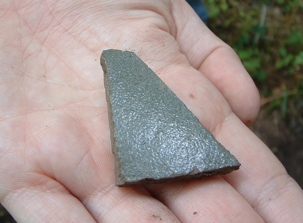
This area was also one of the first homes of John Sevier, the first governor of Tennessee. Overgrown with trumpet vines, tickweed, and river cane, the chimney of his house look for all the world like an ancient jungle ruin, less preserved than persisting. While visiting the grounds, we found on the road surface, and left according to federal regulations, a fragment of a 19th century stoneware vessel, possibly a product of the nearby Decker pottery. The Sevier house is located on a hill with a dramatic view of the river plain.

Federal warning about damaging the site or removing materials


20th century stairs leading to the 18th century ruins of the John Sevier House


Examining the chimney

19th century stoneware found, and replaced, on the surface of the road.
This may have come from a Decker vessel.


After visiting nearly a dozen archaeological sites in Washington County, we stopped and enjoyed (literally) the fruits of the land, on sale at a local farmers' market.


After these two days of focus site survey, we can appreciate the special place in Cherokee history of the site we will begin mapping and excavating over the coming weeks, the Yellow House Site.

Tuesday, June 1, 2010

Day 2 - Survey of Greene County

The overwhelming popular conception of archaeology is excavation: the archaeological dig. But much of archaeology, including much of archaeological field work, involves other investigatory techniques. One of the most important of these is survey.

Dr. Sampeck confers with the students on map locations for some sites to be reviewed during today's survey.


Today the field school students learned about this research method. After a misty morning following a night of rain showers, we undertook a focus site survey of Greene County, Tennessee. A focus survey is one common form of archaeological survey, in which orally-transmitted stories, written documents, or other evidence suggests that archaeological remains might be found at a particular location, either through description of such remains, or discussion of previous human habitation or activity at that place.

Much of the morning was shrouded by mist and clouds, eventually burning off by mid-day.


Students noting the landforms, and surrounding countryside near a potential archaeological site


The distribution of human settlement from the period of contact between Native Americans and Europeans was compared with that during later centuries of English and post-Revolutionary colonization and settlement.


Investigating the area near a known contact-era site

Social, economic, ecological, and geological differences between the societies of these periods produced different cultural landscapes. Amongst settlement evidence examined today were the remains of old roads, difficult to discern through trees and undergrowth. Roads are a vital part of human geography, and an important indicator of political and economic ties and situations.


A roadway sunken into the landscape by years of travelers and their vehicles and animals. The slight concave shape of the land between the trees framing this image shows the road.


On the other hand, we received permission to investigate and explore the Earnest Fort House, a well-preserved structure first built in the late 18th century.

The Earnest Fort House, built about 230 years ago.

This structure, one of the oldest in Tennessee, is listed in the National Register of Historic Places as part of the Earnest Farms Historic District. The architecture of the house is very clearly derived from the Georgian style, but examination of wallpaper, including newspaper from the end of the 19th century used as wallpaper base as well as mid-20th century wallpaper, demonstrates how a site, a building, or an artifact can have a complex life history.

The students documented some of the newspapers built into the walls of the house about a century ago.

This paper was printed on May 6, 1899. The oldest date we could discern was from 1895.

Some appropriate words on past and present, in an old advertisement for pianos

We may not have found ceramics, but at least we found an advertisement for sets of ceramics.

Graffiti helps us understand when these surfaces were in their current condition.
This inscription dates to 1943.

Project members look concerned about the roof of the attic.


The field school includes a lab component on a daily basis. Today the students examined pottery, and compared specific attributes of surface treatment, paste and body construction, as part of a larger discussion of classification and typology in archaeology.